The site of Kish
The archaeological site of Kish is one of the most important sites of Iraq (Figure 1). It spreads across a vast area, about 24 km2, and includes over forty mounds. To help distinguish between them, archaeologists have given alphabetical letters to the mounds, tells, and buildings they explored, as their ancient names cannot always be identified (see Figure 2). The site is located only 15 minutes away from the buoyant city of Hilla in Babil Governorate, and within Nile City and its many palm groves. Kish can easily be reached from Baghdad, as well as from Babylon. It is also close to several other major ancient cities that can be visited, such as Kutha and Borsippa.
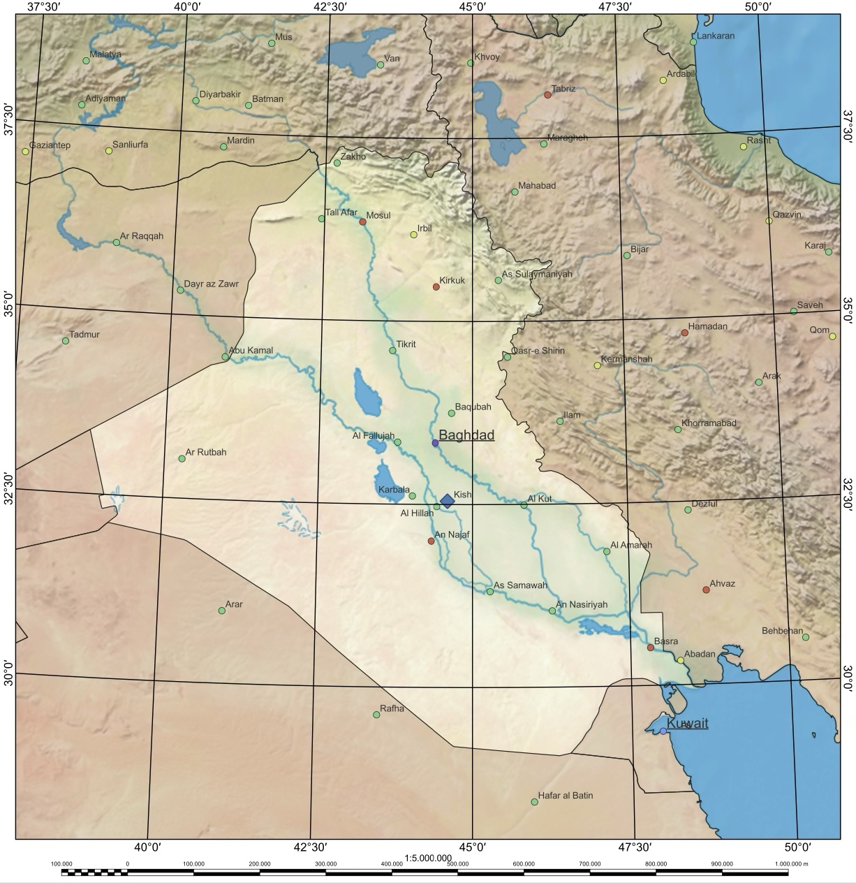 [/kish/images/map-of-iraq-large.jpg]
1. Map of Iraq. Source: State Board of Antiquities and Heritage, May 2024.
The site of Kish takes the name of the ancient city which once stood over the western portion of the site, Tell Uhaimir. Its twin city Hursagkalama, less than 2 km away on Tell Ingharra, was set to the east. Because in antiquity the Euphrates river separated the two cities, canals were built to connect them. We know the Sumerian names of its two main channels, Me-enlila and Buranuna (Zaina 2020: 146).
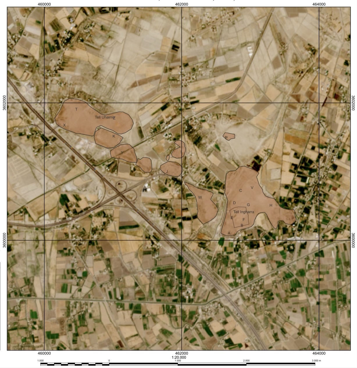 [/kish/images/mounds-of-kish-large.jpg]
2. Map of the archaeological site of Kish with excavated areas marked by letters. Source: State Board of Antiquities and Heritage, May 2024.
Archaeological discoveries at Kish show an impressively long period of occupation of the site, from as early as the Ubaid period (5500-3700 BC) until the Sasanian period (224-651 AD), after which the site seems to have been abandoned. Today, thousands of objects, pottery, and cuneiform tablets preserve parts of the site's history.
Today, the site comprises the following main mounds, from west to east:
- Tell Uhaimir ( Mounds K, T, X, Y and Z)
- Tell Hudhr (Mound I)
- The Plano-Convex Building (Area P)
- Tell Bandar (Mound V)
- The Tablet Mound (Mound W)
- Tell Ingharra (Mounds A-H)
15 Sep 2025
Nadia Aït Saïd-Ghanem
Nadia Aït Saïd-Ghanem, 'The site of Kish', The Forgotten City of Kish • مدينة كيش المنسية, The Kish Project, 2025 [http://oracc.org/MoundsofKish/SiteofKish/]